
We’re glad to announce that TopoLT and ProfLT are now compatible with GstarCAD.

About TopoLT and ProfLT
TopoLT is a program that offers tools for 2D and 3D applications and functionalities useful for those who design topographical and cadastral plans in digital formats, and also for those who develop 3D terrain models and contours, fill and cut volumes calculation, raster image georeferencing and automatic printing. TopoLT is a complete solution for topography and cadastre projects.
ProfLT is a program used in topography that offers a number of functionalities for configuration, modification, drawing, and layout of the longitudinal profiles of the terrain, as well as cross sections. ProfLT application allows the insertion of points from a coordinates file, and based on the codes or on the 3D model the program generates longitudinal or cross profiles.
What are the benefits of TopoLT/ProfLT
Maximum Productivity
With over 25 years of steady growth, innovation, development, and progress, TopoLT offers powerful functions and tools for quick drafting and automatic data processing and users will have their topographic and cadastral plans completed quickly and easily.

Easy loading
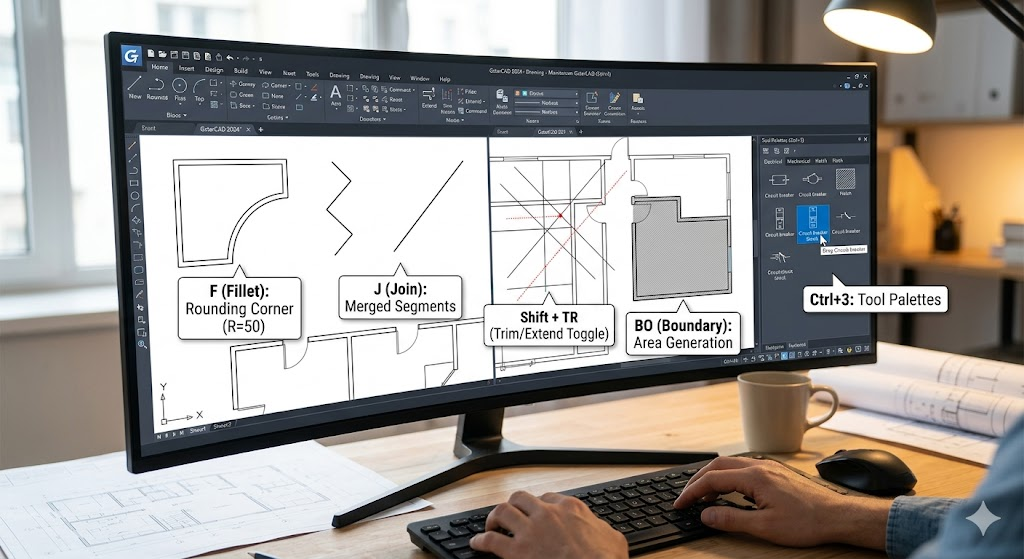
TopoLT and ProfLT applications and be easily loaded into the GstarCAD product you’re using simply by typing the APPLOAD command from GstarCAD.

Put your projects on the map
With TopoLT you can visualize your projects directly in Google Earth.

Download and Try for free
Discover more from Gstarsoft's Blog
Subscribe to get the latest posts sent to your email.


